Property Details
Property Description
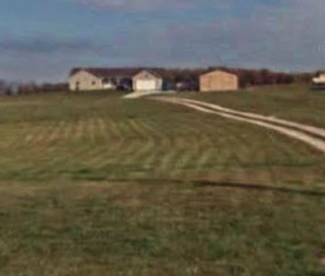
Subject Property is a 3 BR / 2 BA Single Family Home w/ 2 Car Garage containing 2283 Sq Ft +/- built in 2004. Parcel number Q40-001-00-019-12. Minimum bid $ 126,666.67. All auctions end Wednesday's at 1pm. 5% buyers premium will apply over and above high bid. Please read terms and conditions for details related to purchasing foreclosure property. Interior showings are not available. Buyer agents must register with Auctioneer to earn commission at https://www.gryphonusa.com/broker-acknowledgement-form/ *** Information available has come from public sources and is believed to be accurate but is not guaranteed. Photos are for marketing purposes only. Buyers should conduct their own due diligence before bidding. Auctioneer/PSO has not physically viewed the property.
Legal Description
Situated in the State of Ohio, County of Morrow, Township of Washington, being in the northwest quarter of Section 13, Range 21 West, Township 14 North, of "The Congress Lands of 1799-1804", and being bounded and described as follows: Commencing for reference at a railroad spike set in the Centerline intersection of State Route No. 61 and Township Road No. 61 at State Route No. 61 Station 198+68.33 and also being at the Northwest corner of Section 13 (Note: Reference bearing on the North line of Northwest corner of Section 13 used as North 88? 34' 55" East.) Thence, with the west line of Section 13 and the centerline of State Route No. 61 South 00? 12' 36" West a distance of 987.40 feet to a railroad spike set in the centerline intersection with County Road No. 61 (Marion-Williamsport Road) at State Route No. 61 Station 188+79.50; Thence with the centerline of County Road No. 61, South 80? 45' 11" East a distance of 1,304.95 feet at railroad spike set, being the true Point of Beginning for this description. Thence, from said Point of Beginning and leaving the road, North 00? 01' 54" West a distance of 1,054.00 feet to an iron pin set, passing through two iron pins set at distances of plus 30.40 feet and plus 130.40 feet, respectively; Thence North 89? 58' 06" East a distance of 204.00 feet to an iron pin set; Thence South 00? 01' 54" East a distance of 1,087.33 feet to a railroad spike set in the centerline of County Road No- 61 (Marion-Williamsport Road), passing through three iron pins set at distances of plus 7.33 feet, plus 956.93 feet and plus 1,056.93 feet, respectively; Thence, with the centerline of County Road No. 61, North 80? 45' 11" West a distance of 206.71 feet to The Point of Beginning; Containing 5.014 acres, more or less. Subject to all legal right-of-ways, easements, restrictions, reservations, and zoning regulations of record. Subject to the right-of-way of County Road No. 61. Subject to the 100-year flood plain restrictions, if applicable. Subject to a 50.00 feet wide easement being reserved unto the grantors, their heirs, and or assigns, forever. Said easement being for the purpose of running utilities to other parcels of land on or near County Road No. 61. Said easement runs in an east-west direction across the south end of the above-described property with the south line of said easement being the centerline of County Road No.61. Containing 0.237 acres, more or less, of easement. The bearings in this description are for angle calculations only and are based on the south line of the southwest quarter of Section 12 and the north line of the northwest quarter of Section 13 used as an assumed bearing of North 88? 34' 55" East. All iron pins set are 5/8" x 30" feet rebar capped and labeled "Clans 6456". A plat of the above-described survey has been submitted for file at the County Engineer's Office. The above description prepared by Roger W. Claus, Registered Surveyor No. 6456, based on an actual field survey of February 23, 2000; said survey being subject to any facts that may be disclosed in a full and accurate title search.
Location
Foreclosure Details
Click the link to review the Conditions of Sale for this auction.
Conditions of SaleAuction By
