Property Details
Property Description
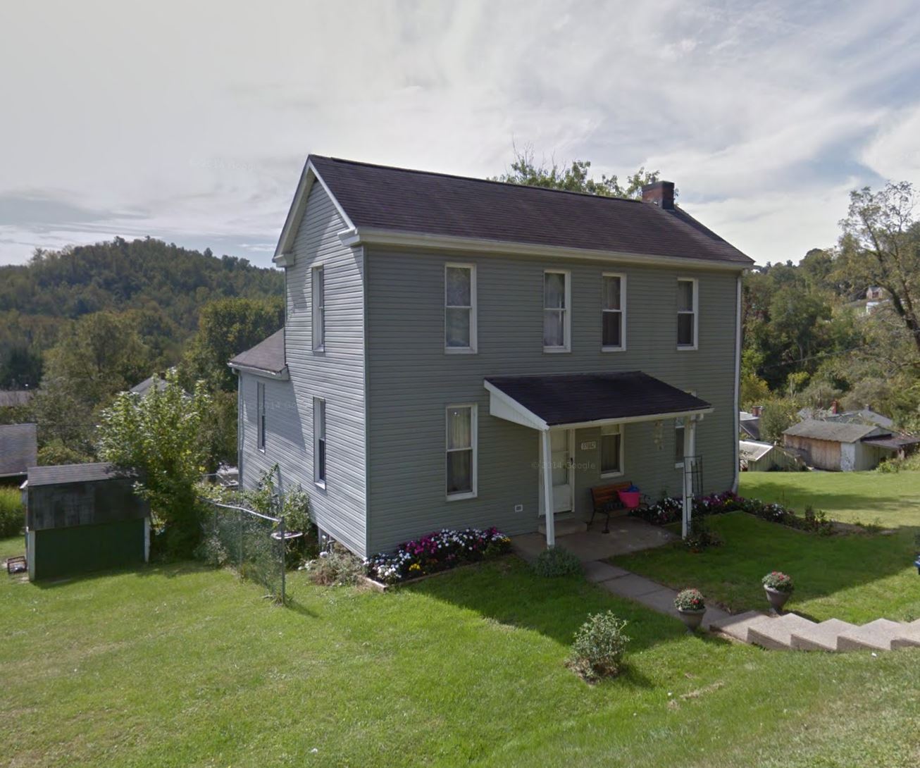
Subject property is a 4 BR / 2.00 BA Single Family Home w/ 1 Car Garage, containing 1,550 Sq Ft +/- built in 1905. Parcel number: 56-01039.001. Minimum Bid $ 18,666.67 . All auction end Wednesdays at 1PM. 5% buyer's premium will apply over and above high bid. Please read terms and conditions for details related to purchasing foreclosure property. Interior showings are not available. To earn a commission, Buyer referrals must be made to Auctioneer before prospective buyers make any contact with Auctioneer or register for bidding. Use link: https://www.gryphonusa.com/broker-acknowledgement-form/ This is a foreclosure situation. Property being offered by Private Selling Officer per the authorities granted in Ohio Revised Code 2329.152 . Information available has come from public sources and is believed to be accurate but is not guaranteed. Buyers should conduct their own due diligence before bidding. List Agent has not physically viewed the property. Due to the nature of the sale, interior inspections are not allowed. Cash sale only. The auction is subject to postponement and cancellation. No financing.
Legal Description
Situated in the State of Ohio, County of Belmont and Township of Pease and being a part of Section 4 in Township 6 of Range 3 and also being a portion of Lot 21 in Crymble and Wilson's Subdivision as recorded in Cabinet "B", slide 208 of the Belmont County Plat Records and being more fully described as follows: Beginning at a 1/2 inch rebar (set) at the northeast corner of said Lot 21 from which an original one inch square iron pin (found) bears the following three courses and distances (1) South 85 deg. 55 min. 00 sec. East, along the south line of Poplar Street, 264.00 feet to the intersection of the east line of Church Street; (2) thence North 04 deg. 05 min. 00 sec. East, along the east line of Church Street, 46.00 feet to aforesaid iron pin from which an original marked stone (found) at the northwest corner of Lot Number 90 in said subdivision bears South 21 deg. 43 min. 13 sec East 872.96 feet; Thence from said place of beginning and with the east line of Lot 21, South 04 deg. 05 min. 00 sec. West 73.08 feet to a 1/2 inch re-bar (set); Thence through said lot, North 81 deg. 14 min. 13 sec. West 56.19 feet to a 1/2 inch diameter re-bar (set); Thence with the west line of Lot 21, North 04 deg. 05 min. 00 sec. East 68.50 feet to a 1/2 inch re-bar (set) on the south line of Poplar Street and at the northwest corner of said lot; Thence with said south line, South 85 deg. 55 min. 00 sec. East 56.00 feet to the place of beginning, containing 3,964 square feet. Subject to all easements, right-of-ways and agreements of record. The Grantees herein, their heirs and successors, are also granted a five foot easement for the maintenance and or replacement of an existing sanitary sewer line and storm sewer line, the centerline of said easement being more fully described as follows. Beginning at a point on the south line of Lot 21 from which the southeast corner thereof bears South 85 deg. 55 min. 00 sec. East 2.5 feet; thence North 04 deg. 05 min. 00 sec. East 77.12 feet to a point on the south line of the foregoing described tract from which a 1/2 inch diameter re-bar (set) at the southeast corner thereof bears South 71 deg. 14 min. 13 sec. East 2.51 feet. The Grantees herein, their heirs and successors, are also granted a five foot easement for the maintenance and or replacement of an existing waterline, the centerline of said easement being more fully described as follows. Beginning at a point on the south line of the foregoing described tract from which a 1/2 inch diameter re-bar (set) at the southwest corner thereof bears North 81 deg. 14 min. 13 sec. West 6.2 feet; Thence South 30 deg. 39 min. 56 sec. West 21.92 feet to a point on the west line of Lot 21. All 1/2 inch diameter iron pins set in this survey are capped with yellows plastic caps stamped "Kyer 6948". All bearings, in the foregoing described tract of land, are based on the bearings given on the plat of Crymble and Wilson's Subdivision. Description prepared by Don S. Kyer, P.S. No. 6948, from the results of a field survey during April of 2002.
Location
Foreclosure Details
Click the link to review the Conditions of Sale for this auction.
Conditions of SaleAuction By
