Property Details
Property Description
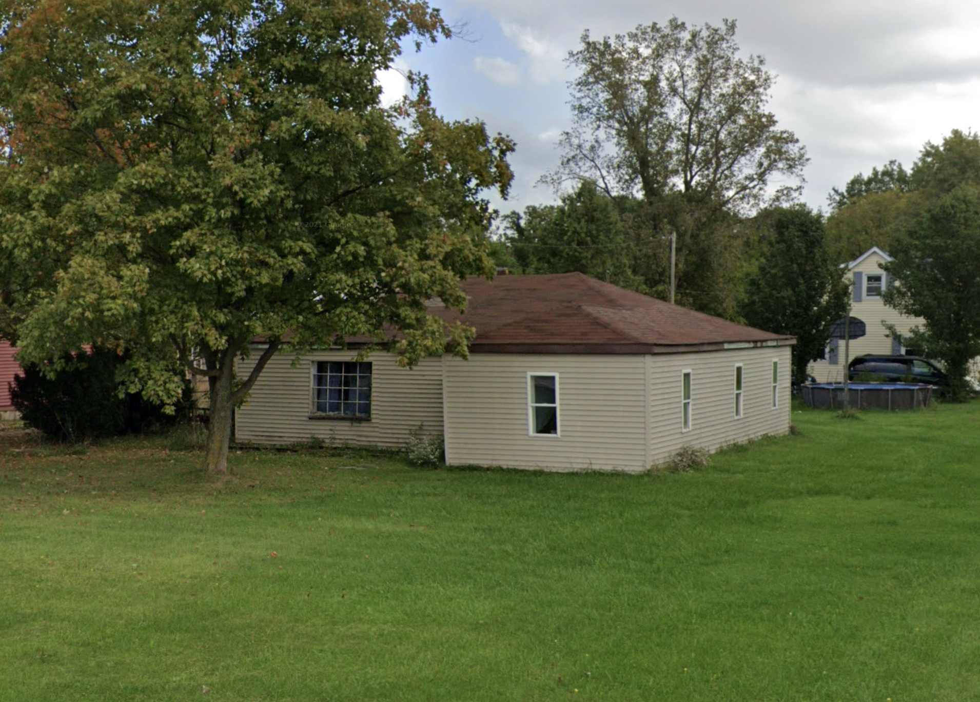
Subject property is a 5 BR / 1.00 BA Single Family Home w/ , containing 768 Sq Ft +/- built in 1940. Parcel number: 410040020010000. Minimum Bid $ 50,000.00 . All auction end Wednesdays at 1PM. 5% buyer's premium will apply over and above high bid. Please read terms and conditions for details related to purchasing foreclosure property. Interior showings are not available. To earn a commission, Buyer referrals must be made to Auctioneer before prospective buyers make any contact with Auctioneer or register for bidding. Use link: https://www.gryphonusa.com/broker-acknowledgement-form/ This is a foreclosure situation. Property being offered by Private Selling Officer per the authorities granted in Ohio Revised Code 2329.152 . Information available has come from public sources and is believed to be accurate but is not guaranteed. Buyers should conduct their own due diligence before bidding. List Agent has not physically viewed the property. Due to the nature of the sale, interior inspections are not allowed. Cash sale only. The auction is subject to postponement and cancellation. No financing.
Legal Description
The following described premises, situated in the Township of Ridgefield, County of Huron, and State of Ohio: Being part of Lot 3, section four (4) of said Ridgefield township and commencing at an iron stake in the Southwest corner of said lot being transferred; located in the east line of the highway Route 99 and running east, seven hundred and forty-seven (747) feet along the north line of the 12 foot driveway belonging to the village of Monroeville, to an iron stake located in the west line of the village dumping ground; thence running north one hundred and thirty-three and one-half (133.5) feet along the west line of said dumping ground to another iron stake located in the Northwest corner of said dumping ground; thence west seven hundred and forty (740) feet parallel with the south line of said property being conveyed to the highway known as Route 99; thence south along said highway one hundred and thirty-three and one-half (133.5) feet to the place of beginning being two and twenty-seven hundredths (2.27) acres more or less. Be the same more or less, but subject to all legal highways. Less and Except: Parcel A Situated in part of Lot number 3, section 4, Ridgefield township, Huron county, Ohio, and being more particularly described as follows: Commencing at a railroad spike found at the intersection of the Centerline of state Route 99 with the northerly line of Lot number 3, said point also being the southerly corporation line of the village of Monroeville; Thence south 01 degrees-00'-00" west, along the centerline of state Route 99, a distance of 103.50 feet to a P.K. Nail set, said point being the principal place of beginning for this description; 1) Thence south 01 degrees-00'-00" west, continuing along the centerline of state Route 99, a distance of 30.00 feet to a P.K. Nail set; 2) Thence south 87 degrees-09'-55" east, along a northerly line of a parcel of land now or formerly owned by the village of Monroeville as recorded in volume 119 page 188 of the Huron county deed records, and passing through a 1/2" iron pin set at a distance of 30.02 feet, a total distance of 451.60 feet to a 1/2" iron pin set; 3) Thence north 01 degrees-00'-00" east, a distance of 30.00 feet to a 1/2" iron pin set; 4) Thence north 87 degrees-09'-55" west, passing through a 1/2" iron pin set at a distance of 421.58 feet, a total distance of 451.60 feet to the place of beginning and containing 0.3109 acres of land but subject to all legal highways, easements and restrictions of record. In the above description the courses were referred to a meridian assumed for the purpose of indicating angles only. Grantors herein claim title by instrument recorded in volume 383 page 462 of the deed records of Huron county, Ohio. This description was prepared by David A. Williams, registered surveyor no. 7166 and was taken from an actual field survey performed on June 28, 1997. Parcel B Situated in part of Lot number 3, section 4, Ridgefield township, Huron county, Ohio, and being more particularly described as follows: Commencing at a railroad spike found at the intersection of the centerline of state route 99 with the northerly line of Lot number 3, said point also being the southerly corporation line of the village of Monroeville; Thence south 01 degrees-00'-00" west, along the centerline of State Route 99, a distance of 133.50 feet to a P.K. Nail set. Thence south 87 degrees-09'-55" east, along a northerly line of a parcel of land now or formerly owned by the village of Monroeville as recorded in volume 199 page 188 of the Huron county deed records, and passing through a 1/2" iron pin set at a distance of 30.02 feet, a total distance of 451.60 feet to a 1/2" iron pin set, said point being the principal place of beginning for this description; 1) Thence South 87 degrees-09'-55" east, continuing along a northerly line of said village of Monroeville parcel, a distance of 326.00 feet to a 3/4" iron pin found; 2) Thence North 01 degrees-59'-40" west, along a westerly line of said village of Monroeville parcel, a distance of 133.91 feet to a 1/2" iron pin set; 3) Thence North 87 degrees-09'-55" west, along the southerly line of a parcel of land now or formerly owned by Marilyn Milkie Herner as recorded in volume 355 page 30 of the Huron county deed records, said line also being the southerly corporation line of the village of Monroeville and the northerly line of Lot number 3, a distance of 319.00 feet to a 1/2" iron pin set; 4) Thence South 01 degrees-00'-00" west, a distance of 133.50 feet to the place of beginning and containing 0.9879 acres of land but subject to all easements and restrictions of record. In the above description the courses were referred to a meridian assumed for the purpose of indicating angles only. Grantors herein claim title by instrument recorded in volume 383 page 462 of the deed records of Huron county, Ohio. This description was prepared by David A. Williams, registered surveyor no. 7166 and was taken from an actual field survey performed on June 28, 1997.
Location
Foreclosure Details
Click the link to review the Conditions of Sale for this auction.
Conditions of SaleAuction By
