Property Details
Property Description
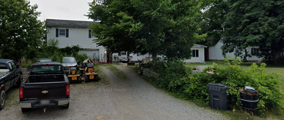
Subject property is a 11 BR / 1.50 BA Single Family Home w/ 2 Car Garage, containing 2,694 Sq Ft +/- built in 1901. Parcel number: 0729657, I27-005-0-0024-00, I27-005-0-0025-00. Minimum Bid $ 55,333.33 . All auction end Wednesdays at 1PM. 5% buyer's premium will apply over and above high bid. Please read terms and conditions for details related to purchasing foreclosure property. Interior showings are not available. To earn a commission, Buyer referrals must be made to Auctioneer before prospective buyers make any contact with Auctioneer or register for bidding. Use link: https://www.gryphonusa.com/broker-acknowledgement-form/ This is a foreclosure situation. Property being offered by Private Selling Officer per the authorities granted in Ohio Revised Code 2329.152 . Information available has come from public sources and is believed to be accurate but is not guaranteed. Buyers should conduct their own due diligence before bidding. List Agent has not physically viewed the property. Due to the nature of the sale, interior inspections are not allowed. Cash sale only. The auction is subject to postponement and cancellation. No financing.
Legal Description
Situated in the Township of Montgomery, County of Ashland and State of Ohio: Being a part of the Northeast Quarter of Section 5, Township 22, Range 16, and being more fully described as follows: Beginning at an iron pin at the Southeast Corner of the Northeast Quarter of Section 5; thence North 86 degrees 45 minutes 00 seconds West 520.20 feet to a railroad spike in the center of Ashland County Road 1175; thence North 3 degrees 43 minutes 00 seconds East along the center of said road a distance of 253.75 feet to a railroad spike; thence North 1 degree 35 minutes 00 seconds West 666.86 feet to a point in the center of said road; thence North 89 degrees 52 minutes 00 seconds East 35.01 feet to a point on the Easterly right of way of County Road 1175; thence North 1 degree 35 minutes 00 seconds West along said right of way a distance of 256.07 feet to an iron pin the true place of beginning; thence North 1 degree 32 minutes 30 seconds West along the Easterly right of way of Ashland County Road 1175, a distance of 252.02 feet to an iron pin; thence South 88 degrees 18 minutes 30 seconds East 199.29 feet to an iron pin said line being the South line of lands now or formerly owned by James and Alice Dean, recorded in Volume 336, Page 468, Ashland County Records, said line also being the North line of lands now or formerly owned by Otis A. Bender recorded in Volume 226, Page 128 Ashland County Records; thence South 58 degrees 59 minutes 30 seconds East 401.72 feet to an iron pin on the East line of Section 5; thence South 1 degree 58 minutes 30 seconds West 37.92 feet to an iron pin; thence South 89 degrees 52 minutes 18 seconds West 535.42 feet to an iron pin the true place of beginning, said line being the South line of lands now or formerly owned by Otis A. Bender recorded in Volume 226, Page 128, Ashland County Records, said line also being the North line of lands now or formerly owned by Howard B. and Inez B. Hartsel recorded in Volume 231, Page 20, Ashland County Records. The aforementioned tract of land contains 1.609 acres of land in Parcel E, and 0.675 acres of land in Parcel E4 for a total of 2.2839 acres of land and is subject to all easements of record.
Location
Foreclosure Details
Click the link to review the Conditions of Sale for this auction.
Conditions of SaleAuction By
