Property Details
Property Description
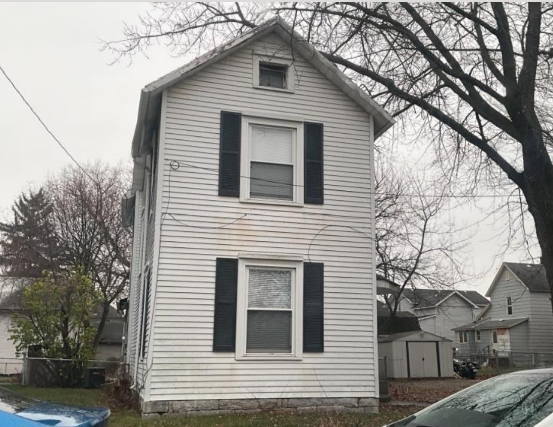
Subject property is a 3 BR / 1.50 BA Single Family Home w/ , containing 1,668 Sq Ft +/- built in 1900. Parcel number: 124180003100, 124180003300. Minimum Bid $ 40,000.00 . All auction end Wednesdays at 1PM. 5% buyer's premium will apply over and above high bid. Please read terms and conditions for details related to purchasing foreclosure property. Interior showings are not available. To earn a commission, Buyer referrals must be made to Auctioneer before prospective buyers make any contact with Auctioneer or register for bidding. Use link: https://www.gryphonusa.com/broker-acknowledgement-form/ This is a foreclosure situation. Property being offered by Private Selling Officer per the authorities granted in Ohio Revised Code 2329.152 . Information available has come from public sources and is believed to be accurate but is not guaranteed. Buyers should conduct their own due diligence before bidding. List Agent has not physically viewed the property. Due to the nature of the sale, interior inspections are not allowed. Cash sale only. The auction is subject to postponement and cancellation. No financing.
Legal Description
Parcel One: Being part of Lot Numbers 1399 and 1400, in Reed Uhler & True's Addition (Plat Book 2, Page 52, Marion County Recorder's Office), to the City of Marion, Marion Township, Marion County, State of Ohio and being more particularly described as follows: Commencing at an existing stone located at the Northwest corner of Lot Number 1399 and Northwest corner of aforesaid Reed, Uhler & True's Addition with the South right of way Line of E. Center Street (82.5 feet wide); Thence along the West line of said Addition and the East line of Lucas & Seffner's Addition (Plat Book 1, Page 239), South 10 degrees 18' 30" East for a distance of 114.08 feet to an iron pin set and the point of beginning; Thence North 85 degrees 34' 25" East for a distance of 49.08 feet to an iron pin set on the common Line between Lot Number 1399 and 1400; Thence along said common Lot Line North 01 degrees 51' 50" West for a distance of 3.88 feet to an iron pin set; Thence North 85 degrees 19' 30" East for a distance of 65.92 feet to an iron pin set on the East line of Lot Number 1400 and West Right of Way line of Uhler Avenue (50 feet wide); Thence along said East line and West Right of Way line South 01 degrees 51' 50" East for a distance of 49.40 feet to an iron pin set: Thence South 85 degrees 29' 20" West for a distance of 108.29 feet to an iron pin set on the West Line of Reed, Uhler & True's Addition (passing over the line between Lots 1399 and 1400 at a distance of 65.91 feet); Thence along said West line North 10 degrees 18' 30" West for a distance of 45.58 feet to an iron pin set (passing over an iron pin set at a distance of 9.05 feet) and the place of beginning. Containing 0.122 acre (5318.02 sq. ft.), more or less. This description prepared from a survey performed by Steven A. Fox, Registered Professional Surveyor 7000, and dated July 14, 1989. All 5/8 inch dia. iron pins set have a plastic identity cap with the inscription "Fox P.S. 7000". Parcel Two: Situated in the State of Ohio, County of Marion, and Township of Marion: Being part of Lot Number 8 in Lucas and Seffner's Addition (Plat Book 1, Page 239, Marion County Recorder's Office) to the City of Marion, Marion Township, Marion County, State of Ohio and being more particularly described as follows: Commencing at an existing stone located at the intersection of the Northwest corner of Lot Number 1399 and the Northwest corner of Reed, Uhler and True's Addition (Plat Book 2, Page 52), with the South Right of Way of E. Center Street (82.5 feet wide), said point also being the Northeast corner of Lot 8 in aforesaid Lucas and Seffner's Addition; Thence along the common line between aforesaid addition South 10 degrees 18' 30" East for a distance of 150.61 feet to an iron pin set and the point of beginning. Thence continuing along said common line South 10 degrees 18' 30" East for a distance of 58.65 feet to an iron pin set at the Southeast corner of Lot 8, said point being on the North Right of Way Line of Grove Street (33 feet wide) (passing over an iron pin set at distance of 9.05 feet); Thence along the South line of Lot 8 and North line of Grove Street South 85 degrees 29' 20" West for a distance of 44.60 feet to an iron pin set; Thence North 01 degrees 59' 35" West for a distance of 58.65 feet to an iron pin set; Thence North 85 degrees 52' 36" East for a distance of 36.10 feet to an iron pin set and the place of beginning. Containing 0.054 acre (2359.11 sq. ft.), more or less. This description prepared from a survey performed by Steven A. Fox, Registered Professional Surveyor 7000, and dated July 14, 1989. All 5/8 inch dia. iron pins set have a plastic identity cap with the inscription "Fox P.S. 7000".
Location
Foreclosure Details
Conditions of Sale
Auction By
