Property Details
Property Description
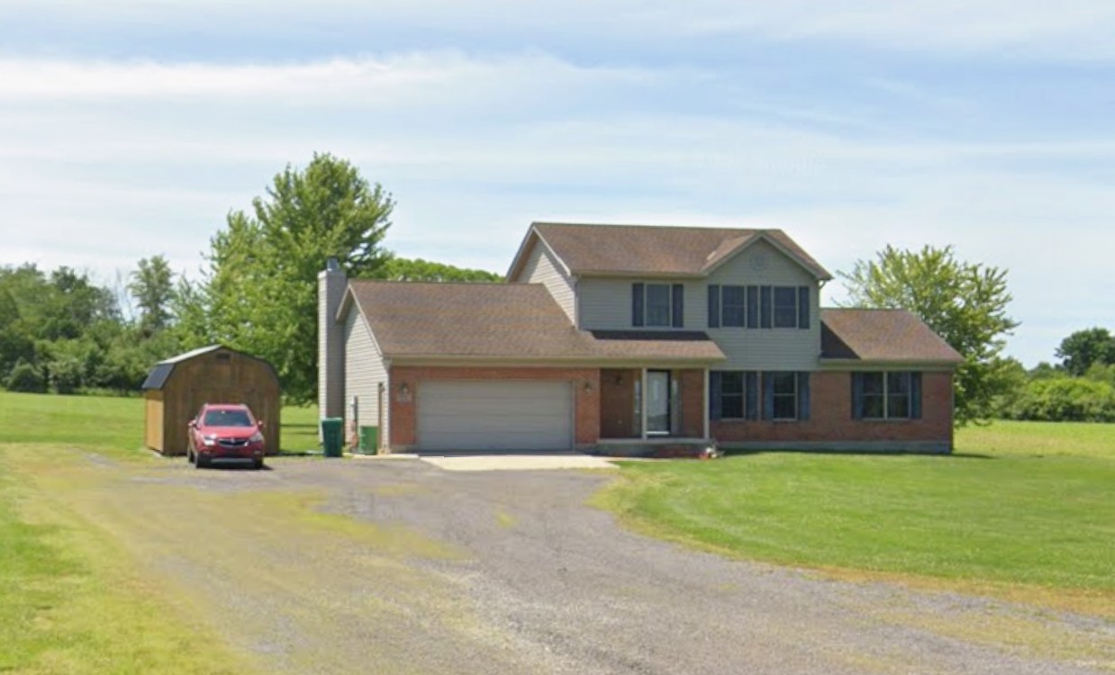
Subject property is a 4 BR / 2.50 BA Single Family Home w/ 2 Car Garage, containing 2,288 Sq Ft +/- built in 2006. Parcel number: 20-14-000-133.00. Minimum Bid $ 200,000.00 . All auction end Wednesdays at 1PM. 5% buyer's premium will apply over and above high bid. Please read terms and conditions for details related to purchasing foreclosure property. Interior showings are not available. To earn a commission, Buyer referrals must be made to Auctioneer before prospective buyers make any contact with Auctioneer or register for bidding. Use link: https://www.gryphonusa.com/broker-acknowledgement-form/ This is a foreclosure situation. Property being offered by Private Selling Officer per the authorities granted in Ohio Revised Code 2329.152 . Information available has come from public sources and is believed to be accurate but is not guaranteed. Buyers should conduct their own due diligence before bidding. List Agent has not physically viewed the property. Due to the nature of the sale, interior inspections are not allowed. Cash sale only. The auction is subject to postponement and cancellation. No financing.
Legal Description
Situated in the Township of Hamer, County of Highland, State of Ohio, being a part of V.M.S. No. 3660 and being further bounded and described as follows: Commencing at a Mag nail (found) marking the centerline intersection of State Route 138 and Watson Road (Township Road No. 204-A); thence with the centerline of Watson Road N 77 deg. 53 min. 56 sec. W, a distance of 1010.26 ft. to a Mag nail (set), said Mag nail being the northwesterly corner of the original 125 acres "Second Tract" as conveyed to Christopher L. Walker (O.R. 624, Page 825) and Christopher Walker (O.R., Page 821) and marking the true point of beginning of the tract of land herein described; thence with Walker's line S 11 deg. 55 min. 22 sec. W, passing a 5/8" iron pin (set) at 30.00 ft., a total distance of 713.63 ft. to a 5/8" iron pin (set); thence with a new division line N 75 deg. 37 min. 32 sec. W, a distance of 180.16 ft. to a 5/8" iron pin (set); thence with another new division line N 11 deg. 55 min. 22 sec. E, passing a 5/8" iron pin (set) at 676.48 ft., a total distance of 706.48 ft. to a Mag nail (set) in the centerline of the aforementioned Watson Road; thence with the centerline of Watson Road S 77 deg. 53 min. 56 sec. E, a distance of 180.00 ft. to the beginning, containing 2.934 acres of land. Subject to all legal easements and rights-of-way of record. Bearings are based upon the Grid Azimuth (AZ. 90 deg. 37 min. 15.9 sec.) between National Geodetic Survey and Highland County Geodetic Survey Monuments "HIG010" and "HIG011" and derived from GPS observations taken March 15, 2006. The above description is a part of the original 50 acres "First Tract" as conveyed to Christopher L. Walker and recorded in Official Record 624, Page 825 and Christopher Walker, Official Record 624, Page 821 of the Highland County Recorder's Office. Land surveyed in March and October 2006, under the direction of Eric N. Lutz, Registered Professional Surveyor No. 7232, the survey plat of which is referred to as Project No. S06-164 on file in the office of McCarty Associates, LLC, Hillsboro, Ohio. The above description is the 1ST division of a 62.7093A acres contiguous tract of land and is subject to the provisions of the Highland County regulations for minor subdivisions.
Location
Foreclosure Details
Conditions of Sale
Auction By
